

Leathabhal [Layaval]
Good walks are even better shared.
Overview
Leathabhal [Layaval]
Nestled in the majestic landscape of the Outer Hebrides, Leathabhal stands proud at 641 meters. Known as a Marilyn, it offers stunning views and a variety of routes for outdoor enthusiasts of all skill levels.
Geology
Leathabhal is primarily composed of ancient Lewisian Gneiss, one of the oldest rocks in the world, boasting a rich geological history that beckons rock hounds and geology buffs alike. The wear of time is evident in its rugged cliffs and rolling hills, showcasing a beauty sculpted over billions of years.
Routes
West Coast Route
Starting from Borve, the West Coast Route is a perfect choice for those looking to enjoy the coastal scenery while trekking up to the summit. This moderate route is about 7.5 km and will take roughly 3.5 hours to complete, making it a delightful day out for hikers.
East Ridge Approach
For those craving a challenge, the East Ridge Approach is a direct and thrilling 5 km route. With a trek time of around 2.5 hours, be prepared for a solid workout, and remember, what goes up must come down!
Summit Features
At the top, you'll find a sizable cairn marking the summit, along with breathtaking views that make the climb worth every step. It's a popular spot to take a breather and soak in the surrounding beauty.
Terrain
The terrain varies greatly, with rocky outcrops and lush heather giving way to occasional boggy patches. Proper footwear is a must to keep your feet happy and dry!
Views
The summit grants panoramic views of the stunning Outer Hebrides, including Harris and Lewis. When the weather is on your side, the vistas are downright jaw-dropping, offering excellent photography opportunities or a simple chance to daydream.
Hazards
Always be wary of the unpredictable Scottish weather; it can change quicker than you can say 'tartan!' Also, watch your step on loose stones and stay clear of any cheeky sheep who might want to steal your lunch.
Access
Leathabhal is easily accessible from Borve, with parking available for adventurers. Stornoway, the nearest town, has plenty to offer in terms of food and lodging, ensuring you are well-prepared for your mountain escapade.
Facilities
A short journey back into Stornoway will provide you with cafes, restaurants, and toilet facilities that are essential before tackling the great outdoors.
History
The name 'Leathabhal' suggests a rich tapestry of cultural lore. Its Gaelic roots reflect a deep connection to the land and its people, making it a significant jewel in the crown of the Outer Hebrides.
So lace up those boots, grab your walking stick, and don’t forget your sense of humour – adventure awaits!
Conclusion
Leathabhal offers an exhilarating experience for hikers, with its rich history, stunning geology, and breath-snatching views. Whether you're a seasoned mountaineer or a casual walker, this mountain is a must-do on any Hebridean itinerary. Happy hiking!
Explore routes near Leathabhal [Layaval]
Public walks starting within 80 km of this hill. Nearby does not mean a route reaches the summit; check its map and access before setting out.
Dun Mhulan Broch Quick Walk
View route
Berneray Community Hall to the beautiful beach
View route
Route planning notes
These notes describe possible approaches, not verified navigable routes or permission to cross land. Check current paths, local access rules and conditions before setting out.
West Coast Route
A scenic route starting from the small village of Borve, taking you along the coastline before ascending the southwest ridge, with stunning views of the Atlantic Ocean.
East Ridge Approach
A slightly more direct route that ascends from the eastern side, offering a brisk trek through heather-covered hills before scaling the rocky summit.
Make a day of it, together
Find someone to share the walk with, or organise a day out along a route you like.
Photo Gallery
View all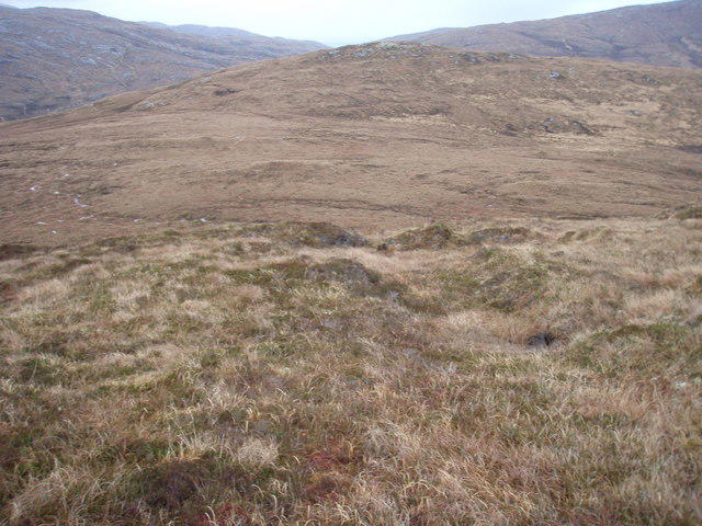 Photo could not load
NF7723 : View along the ridge to Beinn Hurabhat
Roger McLachlan
Hill facts and local notes
Classifications
Elevation
182m
597 ft
Prominence
117m
Coordinates
57.1895, -7.3398
NF775236
OS Map
22
Explorer: 453S
At the Summit
The summit is marked by a substantial stone cairn, which serves as both a navigational point and a place for weary hikers to rest while enjoying the panoramic views.
Terrain & Geology
Primarily composed of Lewisian Gneiss and schists, Leathabhal features some fascinating geological formations shaped over billions of years. The intricate layering gives the mountain a rugged appearance that's a sight to behold.
Views & Scenery
From the summit, one can see the vast expanse of the Outer Hebrides, including the islands of Harris and Lewis. On a clear day, the breathtaking vistas stretch far into the distance, truly a feast for the eyes.
History & Heritage
Name Origin
Leathabhal is derived from the Gaelic 'Leathabhal', translating approximately to 'the hill of the groves', hinting at its lush surroundings.
Historical Significance
The mountain is a popular destination for both local and visiting hikers, and it holds cultural significance for the local communities as a traditional gathering spot.
Getting There & Facilities
Check current local access restrictions, parking rules and transport timetables before travelling. These notes do not confirm public access to the summit.
Parking
Parking is available at Borve, approximately 1 km from the trailhead. There's no charge, but spaces fill quickly in peak season.
Public Transport
Buses from Stornoway to Borve operate regularly, making it relatively easy to access the trailheads without a car.
Nearby Facilities
While amenities are sparse on the mountain itself, Stornoway offers several cafes, restaurants, and toilet facilities to prepare for your journey.
Safety Information
Known Hazards
- Beware of rapidly changing weather conditions, loose rocks, and the occasional mischievous sheep. Proper footpaths can become slippery when wet.
General Safety Tips
- Check weather conditions before setting out
- Carry appropriate clothing and equipment
- Let someone know your planned route
- Take a map, compass, and GPS device
- Carry emergency supplies: food, water, first aid kit, torch
Hills
Some common questions about the hills answered
Are there group walks up Leathabhal [Layaval]?
Many walkers use Walkmates to join or organise walks with others. You can check for group walks around Leathabhal [Layaval] through the maps
Are there other walkers around Leathabhal [Layaval]?
Activity varies by location and time, but Walkmates lets you see whether others have shared walks or shown interest in this area. Find other people through the walking friends search walking friends for Leathabhal [Layaval] search or of course create your own walk for Leathabhal [Layaval]
Can I organise a walk to Leathabhal [Layaval]?
Yes. If there aren’t any walks listed already, you can create a walk and make it available for others to join.
If you're signed up to Walkmates, you can create a walk to Leathabhal [Layaval].
How do I find a walk up this hill?
There are often multiple ways to walk this hill, depending on experience and route preference. Walkmates helps you explore walks and routes that others have shared.
Can I suggest a new route up Leathabhal [Layaval]?
Yes. You can suggest or create routes to share with others. Walkmates focuses on the social side of walking, so routes are used to help people organise walks and explore areas together, rather than as detailed navigation tools or route libraries.
Other uses really appreciate knowledgeable walkers sharing their routes. Share your favourite route to Leathabhal [Layaval] here
The is an error or something incorrect about this hill. How do I let you know?
We always strive to keep the information on Walkmates as accurate as possible. If you find an error, please let us know through the contact form and we'll aim to correct it as quickly as possible
Community Discussion
Comments
Location
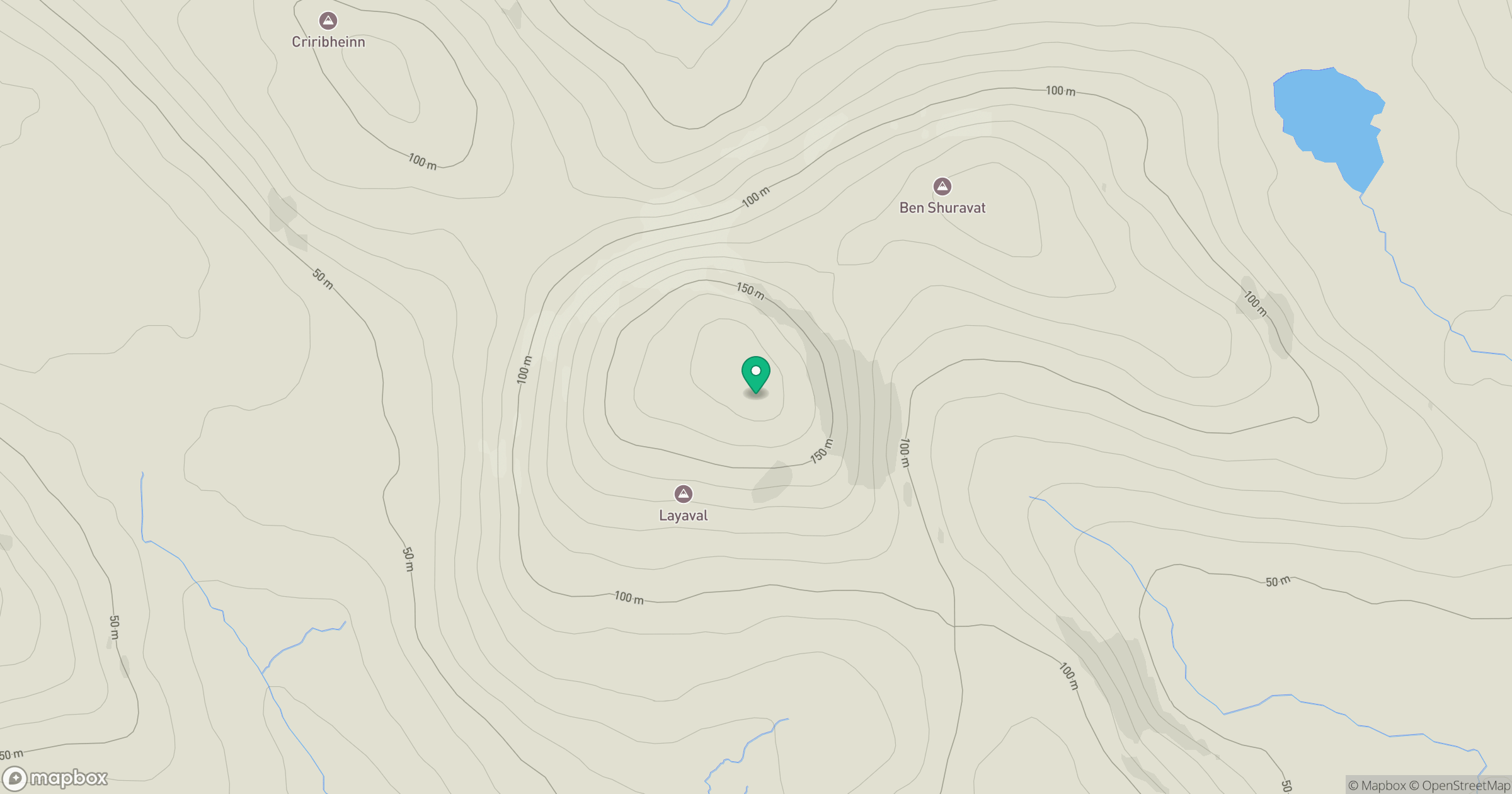
Grid reference: NF775236
View on OpenStreetMapOpens a map in a new tab, centred on the hill.
Hills within 30 km
Straight-line distance, not a walking route or confirmation of access.
Airneabhal [Arnaval]
255m
Heabhal [Seabhal]
223m
Beinn Ruigh Choinnich
276m
Triuirebheinn
357m
Easabhal [Easaval]
242m
No comments yet. Be the first.